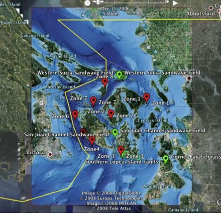
Screenshot of Google Earth with SeaDoc’s bathymetry overlay.
Have you checked out what the San Juan Islands look like in Google Earth? Maybe you've noticed that you don't get much detail on what's underneath the surface. Never fear. SeaDoc and the Tombolo Mapping Lab (now affiliated with SeaDoc) have an "overlay layer" you can download for Google Earth. The file will superimpose our bathymetry data on top of the Google Earth data, giving you a bird's eye view of the underwater geography.
These basemap images work in the desktop version of Google Earth. That's the one you download to your computer, not the one you use online in Google Maps.